Over the past few weeks we've been surveying the coverage from our current Gateways. We've used TTNMapper to get a physical idea of the coverage. One of the issues with surveying is that the absence of a point doesn't mean no coverage but could mean a number of things.
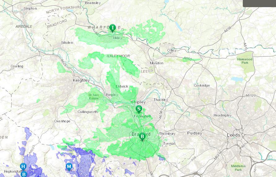
Once we had a number of points we started looking at viewsheds and we've created a map of current coverage for Bradford, Calderdale and Manchester. If you have gateways in neighbouring areas and are interested then please get in touch.
The viewshed takes into account the height of the gateway above ground and plots a polygon where we should have coverage. It takes no account of objects like buildings and trees and uses a 30 metre digital elevation model. It is very indicative and in the future we hope to add polygons where there is definitely no coverage.
Living in hilly areas means we have sudden drop outs of coverage so a simple circle over a gateway tells us very little.
Visit the coverage map. You can also make a line between 2 points and get a graph of the profile.
Thanks
Steve James