Nice to know, I ll try to find how can I get this HDOP right now. Percentage was just a “guess” but I understood, near to 1 is good ! The mine that I’m talking about is an open pit mine.
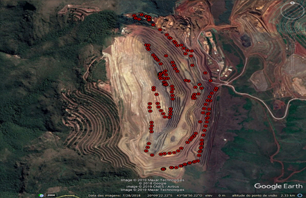
There is several different levels (as you can see in this image), in order to identify which level of the road my sensor is I ll use the altitude.