I did some tests and we had quite of good results. The line in red represents a commercial GPS for vehicles and the “circular points” are the coordinates from my lora device.
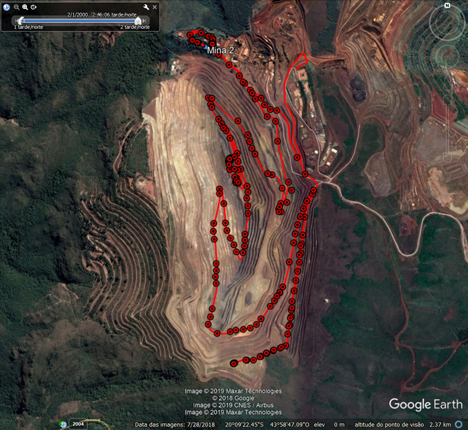
The climatic conditions were good in the day of the test Temperature min 24 ºC , max 32 ºC, the relative humidity was 22%-57%.
We would like to track some grader,hidraulic shovel,sandvik mobile screen, trucks. I think can be a nice project for lorawan, because is an open space. I need to pay attention in the GPS accuracy as you said, do you have any other tip? =)
The mine tip has around 400 m (depth)
I’m working in Brazil !