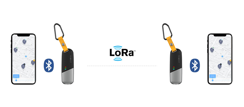
“Compass”is MAXIIOT’s newly released LoRa based GPS tracking device for tracking various assets and the living equipped with rechargeable battery . Integrated with LoRa+GPS+BLE chips , which enable “Compass” pairs with your phone and transmit GPS location from device to device through LoRaWAN network. Low power consumption combine with private network,makes it ideal for outdoor adventure and traveling .
In this project , we will show you how to get a GPS data from a remote LoRa based GPS tracker and the maximum communication range that can achieve between two LoRa trackers.lets get started!
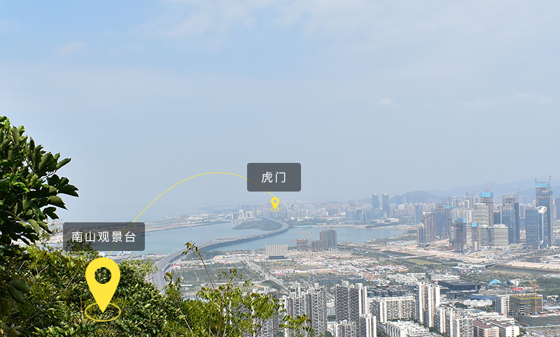
1、Overview of Test Environment
Node 1 located at observation deck of Nanshan. Node2 moves from Qianhai to Dongguan through Yanjiang highway. The observation deck is open, with few buildings around , facing the Yanjiang highway.
2、Test Method
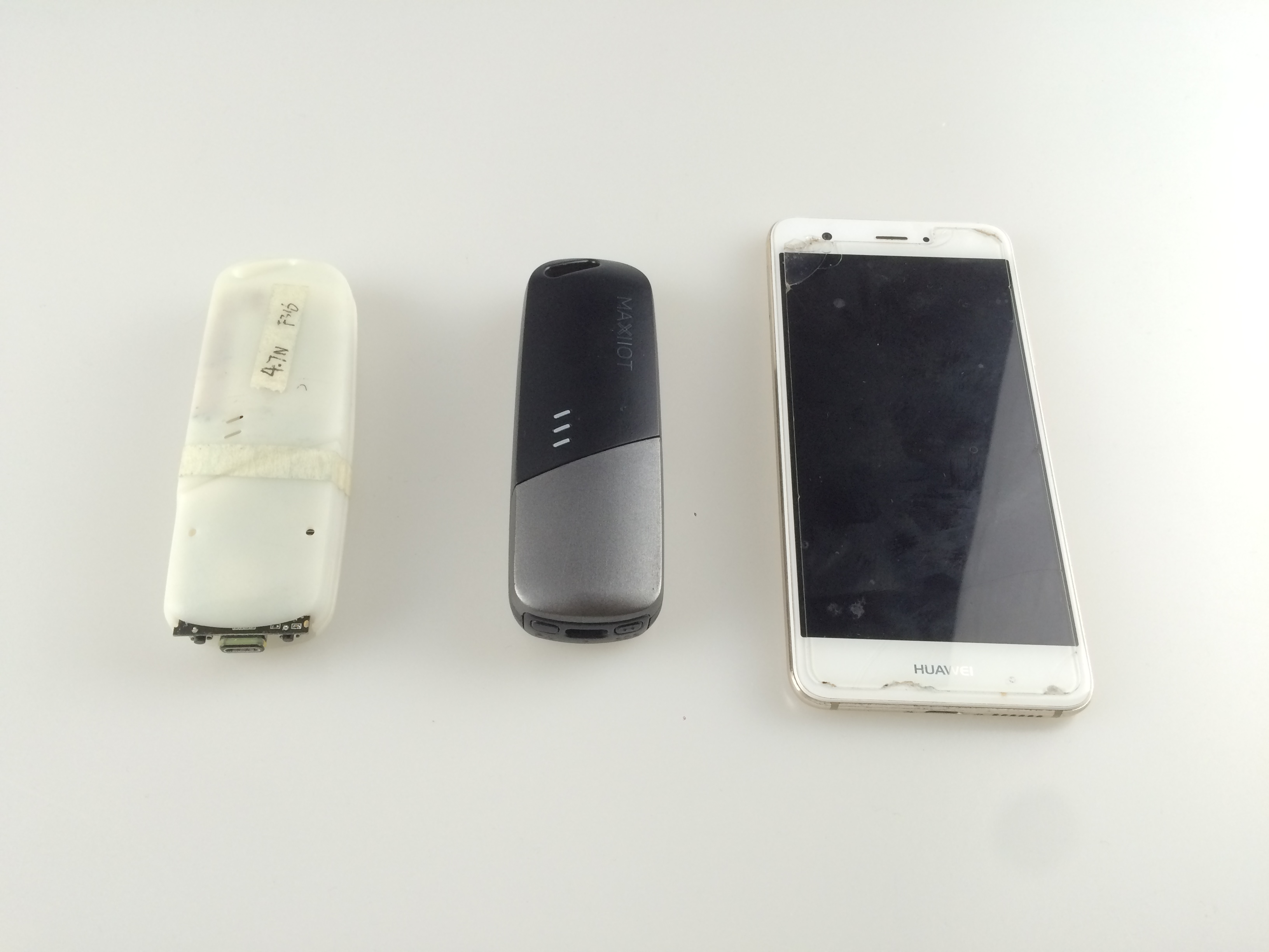
Required devices: 2LoRa GPS Tracker+1 mobile phone.
LoRaWAN data rate: DR0(SF12,BW125)
Divide the test team into two groups .
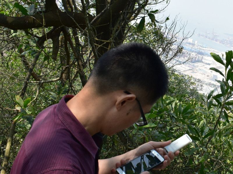
Group 1: One LoRa Tracker(node 1) +one mobile phone , climbs to the empty observation deck of Nanshan. about 275 meters above sea level.
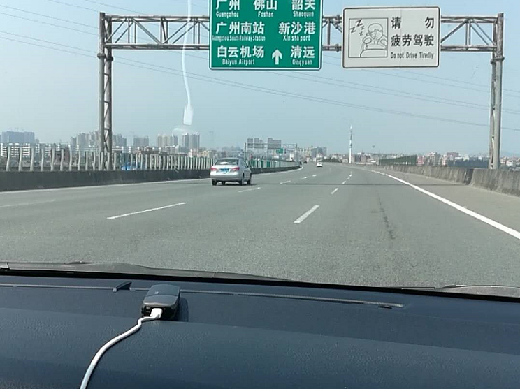
Group 2: One LoRa Tracker(node 2), heading to Humen from Qianhai, vehicle speed around 80Km/h on Yanjiang highway.
Operation:
Step 1: Node 1 pairs with the mobile phone ,open test APP .
Step2 : Node 2 send GPS location message to Node 1 every 2 minutes by default .
If received , will get receive notification in app .
if not received , display"Activity unbound to the service ".
3. Running Result
The following are some representative data:
-
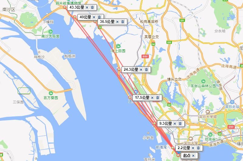
Starting Point( where node1 is ) : Observation deck of Nanshan. about 275 meters above sea level.
-
Near Qianhai branch of ABC : node2 is 2.2KM away from node1, few buildings around, high receive sensitivity , no packet loss.
-
Close to Bihai fortis city iii:node2 is 9.3KM away from node1, no building around, high receive sensitivity , signal stable, no packet loss.
-
Near Bao’an International Airport:node2 is 17.5KM away from node1,Packet loss rate increasing sharply due to the impact of airport signal shielding ,when left airport area , signal recover , no packet loss .
-
Fuyong toll station:node2 is 24.3KM away from node1, no building around, high receive sensitivity , signal stable, no packet loss.
-
Near Xin’an East Road,Dongguan:node2 is 36.5KM away from node1, no building around, high receive sensitivity , signal stable, no packet loss.
-
NiutauShan Tunnel:node2 is 40.0KM away from node1, packet loss rate increase due to the impact of mountains .
-
Near Dongguan University of Technology :node2 is 43.3KM away from node1, a lot buildings around, packet loss rate increase to 100% due to urban environment , test ended .
- Conclusion and Notices
This project further validates the advantages of LoRaWAN wireless communication .In outdoor environment without obstacles, the air to air communication range between two LoRa end-device is over 40KM .
Notice :You have to be aware that Radio link quality and performances are highly dependent of environment. Better performances can be reached with:
-Outdoor environment,No obstacles.
-No high level radio interferer in the ISM band.
-At least 1 meter above the ground.
Radio communication are usually killed with bad topographic conditions. It is usually not possible to communicate through a hill, even very small.

