Well I’ve had a bit of a delay in getting round to trying again.
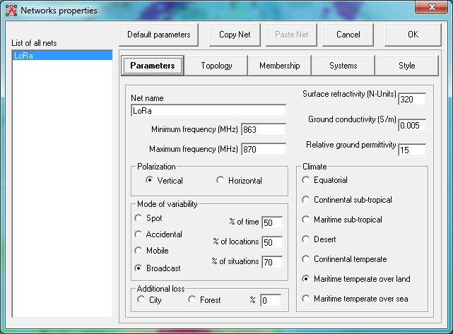
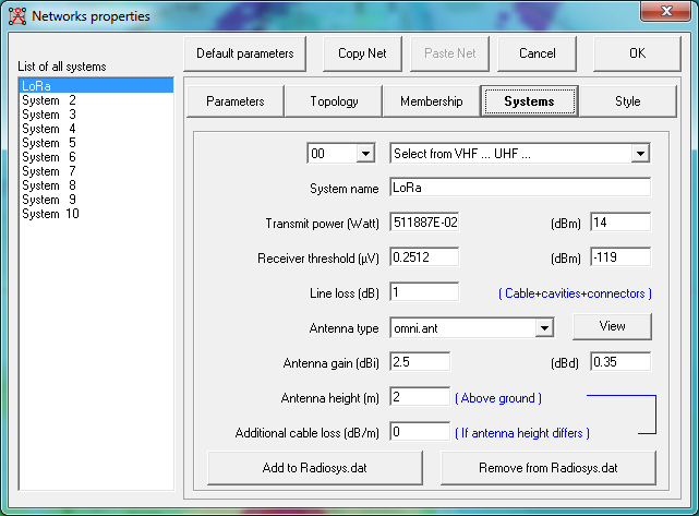
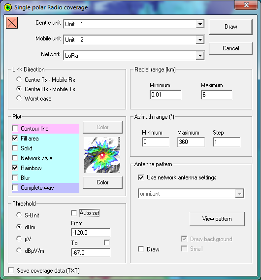
I’ve generated the following using the following settings:
Params
Systems
Topology is slave / master, both units are members and at 2M Antenna height for the base station (It’s about 2-3M and I need to re-measure, going with 2M as a worse case, car is around 1.5M high)
Unit properties has both added at the correct co-ords,
And using the coverage calculator:
Generated map
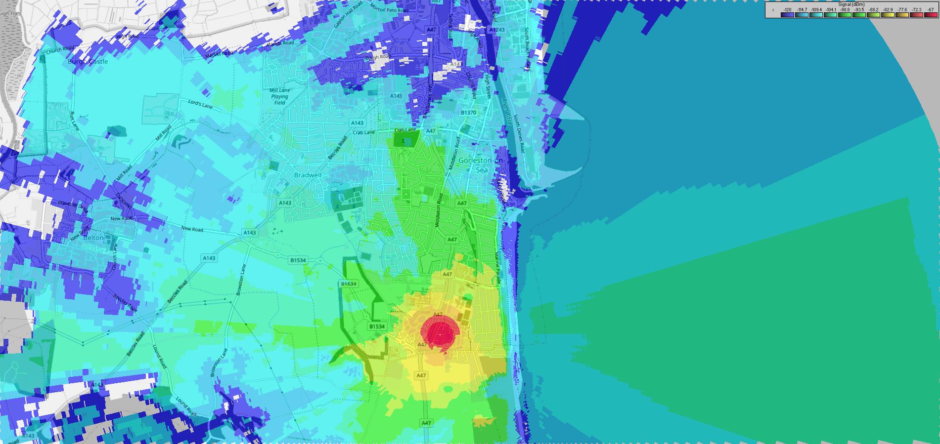
And the coverage predicted is quite a bit more than what I’m getting. I’m trying to calculate it out using what I have now to have a visual ideal of roughly what coverage I will then get after. https://ttnmapper.org/colour-radar/?gateway=ttngy-gw1&type=radar