Hi, just a newbee here and managed to get my Gateway and devices running ( 2 trackers) based on:
https://www.thethingsnetwork.org/labs/story/lorawan-gsp-tracker
both device Anduino ProMini 3.3v and uploaded with version 1.8.5 of the Anduino compiler. My problem is the altitude represented in the TTN. As i believe the raw data out of the GPS (gy-gps6mv2) is correct its list a 45.9M
$GPGGA,213006.00,xxxx.xxxxx,N,xxxx.xxxxx,E,1,05,1.53,-19.5,M,45.9,M,*45
as i am sea level this has to be corected with 43M-46M so close to zero. Coordinates on Latitude and Longtitude are spot on.
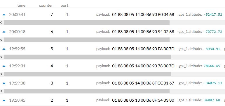
as i the picture my altitude on the TTN console varies from 78644.45 to -/- 70772.72 and as reading of 45,9M in the raw data is good is suspect the sketch is the problem. Can someone hint me to the place i need to look in the sketch. played around with coord(8) (9) and (10) but no good results.
Help is much appreciated ! Thanks Guys/Girls